
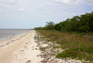
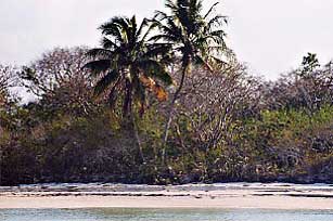
Top Left: Middle Cape looking south. Shows treed berm and pristine shell beach before the 2005 hurricanes. Top Right: Northwest Cape before the hurricanes.
East, Middle and NW Cape cover 11.6 miles of nearly continuous beach. The once treed and grassy berms behind the beach are interrupted by three prairies.
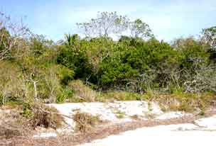

This picture of gopher tortoise habitat on Middle Cape berm before the hurricanes illustrates the treed and grassy vegetation important to this species.
Above a gopher tortoise climbs the steep slide from the beach to its hole on the berm. Note how high the berm is above the beach (also seen in photo on the left).
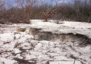
This post hurricane picture is of the same gopher tortoise area displayed above. We believe that the trench is a collapsed gopher tortoise hole/tunnel.
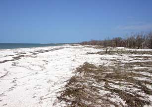
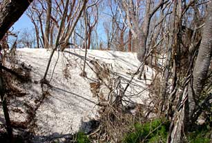
Here one can see how the hurricanes deposited shell sand not only on the beach but over the grassy berm eliminating the steep banks.
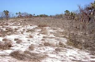
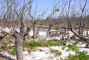
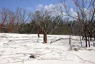
The prairies also received a heavy dose of sand from the hurricanes.
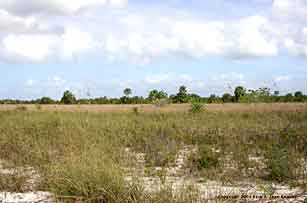
This before picture of Northwest Cape prairie was taken in 2004.
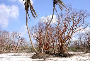
Here is a before close-up of the berm vegetation near the coconut palm trees pictured to the right. There are lots of cactus, natives trees and exotic lead tree.
This more panoramic look at the same area, referred to by boaters as Twin Palms, illustrates how heavily vegetated pre-hurricane Middle Cape was.
This is what Twin Palms looked like on March 14, 2006. Note the exposed palm root structure and lack of understory vegetation.
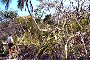
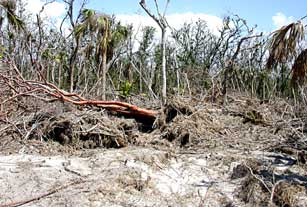
Here we see the ragged stumps of snapped black mangroves. The discarded trunks are piled up in the background.
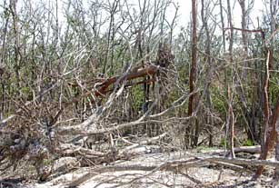
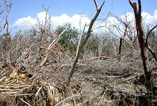
Hurricane wind forces are evident in the above photo of an uprooted "flying gumbo limbo" being held by the outstretched branches of a downed buttonwood.
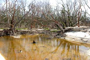
Dredged holes in the beach/berm attest to significant hurricane force winds. Exposed roots of toppled trees and huge sand banks are in the background.
The height of some hurricane sand deposits reached four to five feet at their inland edge as seen above.
Such deep sand deposits buried the trunks of many trees like the gumbo limbos in the above photo.
At Northwest Cape hurricane debris was washed to the back wall hammock nearly a half mile from Florida Bay. This hardwood hammock consists exclusively of species of West Indian derivation.
The once shady, mature hammock behind Northwest Cape prairie is now reduced to rubble. It was the only known home of the tree snail, Liguus fasciatus elliotensis var. capensis
Hurricanes historically have hammered this area of Everglades National Park, the last being Hurricane Donna in 1960. It is hard to believe that pre-hurricane Katrina /Wilma Cape Sable could have evolved in just 45 years. We lament the research opportunities lost from the study of lichens to gopher tortoises to the beautiful tropical coastal hammocks (hardwood forests). But we did one thing right. We worked hard to eradicate the aggressive non-native Brazilian pepper, Schinus terebinthifolius, from this area. If not, it is likely to have taken over after this upheaval.